Top 10: Construction Drones
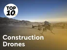
Construction drones are unmanned aircraft used to capture aerial imagery, measurements and sensor data across a building or infrastructure project.
Early construction applications focused on photography and basic surveying, but improvements in GPS, photogrammetry, LiDAR, thermal imaging and onboard autonomy have expanded their role.
Today, teams use drones to map land, calculate stockpile volumes, compare as-built work with plans, monitor progress and inspect hazardous structures without putting workers at unnecessary risk.
One company dominates in this arena. DJI represents around 70% to over 90% of all drones deployed on commercial and private construction sites globally for surveying, aerial mapping and progress tracking.
From Real-Time Kinematic (RTK) mapping to autonomous inspection, these are the leading construction drones for surveying, progress tracking and site safety.
10. Flyability Elios 3
Provider company: Flyability
CEO: Patrick Thévoz, co-founder and CEO
Main purpose: Collision-tolerant indoor inspection and mapping in confined or GPS-denied construction environments
Flyability Elios 3 is an indoor drone for inspection and mapping.
Its protective cage allows the aircraft to make controlled contact with walls and other surfaces.
This makes it suitable for confined spaces such as shafts, tunnels, tanks, culverts, plant rooms and incomplete structures.
Its FlyAware system combines computer vision, LiDAR and onboard computing to support stabilisation, positioning and real-time 3D mapping.
The aircraft has a 4K camera, lighting and a modular payload bay with dedicated LiDAR and auxiliary-payload ports.
9. DJI Matrice 30T
Provider company: DJI
CEO: Frank Wang
Main purpose: Rapid visual, thermal and zoom inspection on medium and large
The Matrice 30T is a compact enterprise inspection drone that integrates several sensors into one aircraft.
Its payload is not swappable but the built-in combination of wide-angle, zoom, thermal and laser-rangefinder cameras means operators can respond quickly without changing equipment in the field.
The thermal camera is useful for electrical checks, building-envelope investigations, mechanical equipment and locating temperature differences that may warrant closer inspection.
The zoom camera supports detailed views of façades, roofs, cranes and infrastructure from a safe distance.
8. JOUAV CW-15
Provider company: JOUAV
CEO: Ren Bin
Main purpose: Long-endurance VTOL mapping, surveillance and inspection

The JOUAV CW-15 is a fixed-wing Vertical Take-Off and Landing (VTOL) aircraft intended for long-duration missions across large areas, including mapping, surveillance and infrastructure inspection.
JOUAV quotes up to 180 minutes of endurance when empty and up to 120 minutes with its MG-120E payload.
That makes it useful for linear infrastructure, expansive developments, quarries and remote projects where repeated multirotor launches would be inefficient.
Its open architecture is attractive to organisations that need to integrate specialist cameras, LiDAR or other sensors.
7. DJI Mavic 3 Enterprise
Provider company: DJI
CEO: Frank Wang
Main purpose: Portable mapping, surveying, progress monitoring and everyday site documentation
The DJI Mavic 3 Enterprise is portable, making it practical for project managers, surveyors and site teams that need to collect aerial data frequently.
Primarily a mapping and documentation aircraft, it supports orthomosaics, 3D models, stockpile measurement, earthworks tracking and repeatable progress photography.
Highlights include a mechanical shutter, a 56× zoom camera and an RTK module for centimetre-level precision. DJI quotes a maximum flight time of 45 minutes with the standard battery and propeller configuration.
6. WingtraOne GEN II
Provider company: Wingtra
CEO: Maximilian Boosfeld, co-founder and CEO
Main purpose: Large-area topographic surveying and high-resolution mapping
The WingtraOne GEN II is a fixed-wing VTOL mapping drone rather than a close-range inspection multirotor.
Its distinctive design allows it to take off and land vertically, then transition to efficient fixed-wing flight over large areas.
That makes it especially suitable for construction surveying, road corridors, quarries, mines, utilities and extensive earthworks.
Coverage and efficiency are its main strengths. A survey team can map much more ground with one flight than with a conventional multirotor, reducing the number of flights required on a large site.
5. Autel EVO Max 4T / EVO II Pro RTK V3
Provider company: Autel Robotics
CEO: Li Hongjing
Main purpose: Compact thermal, visual and mapping work where obstacle awareness and supply-chain choice matter
Autel’s EVO Max 4T is a compact enterprise drone combining wide-angle, zoom and thermal imaging with a laser rangefinder.
The optional RTK module is intended to provide centimetre-accurate positioning for mapping and to improve navigation around structures that may create electromagnetic interference.
Its Payload software developer kit and screw quick-release interface provide some modularity. The integrated thermal camera is valuable for electrical inspections, moisture investigations and identifying heat-related anomalies, while the laser rangefinder can support measurements to distant features.
4. Skydio X10
Provider company: Skydio
CEO: Adam Bry
Main purpose: Autonomous construction documentation, inspection and reality
The Skydio X10 is a strong obstacle-avoidance and autonomy proposition.
It combines visual navigation, AI and a multi-camera sensor suite to help the aircraft understand its surroundings and navigate around obstacles.
That is particularly valuable on construction sites containing cranes, steelwork, scaffolding, cables, partially completed buildings and other structures that can make manual flying demanding.
The aircraft is well suited to repeatable progress documentation, façade and roof inspection, asset assessment and remote site visibility.
3. DJI Matrice 4 Enterprise
Provider company: DJI
CEO: Frank Wang
Main purpose: Portable surveying, inspection, progress monitoring and detailed
The Matrice 4 Enterprise is much lighter than the Matrice 30T .
Its camera system comprises a high-resolution wide camera and telephoto capability, with optional enterprise accessories.
Operators can use the camera to document construction milestones, inspect difficult-to-access areas and create mapping data.
The aircraft is therefore suitable for teams that need high-quality mapping and inspection data but may not suit those who do not always require a heavy-lift aircraft.
That makes it appealing for medium-sized sites, roof surveys, façade inspections, earthworks monitoring and repeatable progress flights.
2. DJI Matrice 350 RTK
Provider company: DJI
CEO: Frank Wang
Main purpose: General-purpose enterprise mapping, inspection, surveying and infrastructure monitoring

The Matrice 350 RTK is one of the most established heavy-duty construction platforms.
It represents a different class of drone to its 4 Enterprise peer which is lightweight, portable and over half the price.
The 350 RTK is designed as a reusable aircraft system rather than a single-purpose camera drone, supporting mapping, inspection, public-safety and infrastructure workflows.
Its maximum flight time of 55 minutes in addition to an IP55 rating which is intended to protect the aircraft against dust and water exposure makes it suitable for industrial environments.
It can carry up to 2.7kg and supports configurations involving as many as three separately purchased payloads, depending on the gimbal arrangement.
Construction teams can therefore use one aircraft for orthomosaic mapping, detailed asset inspection and thermal assessment.
Six-directional sensing and positioning, a night-vision FPV camera and the DJI RC Plus controller add operational resilience.
It is a strong choice for contractors who need a proven platform with broad sensor compatibility.
1. DJI Matrice 400 RTK
Provider company: DJI
CEO: Frank Wang
Main purpose: Heavy-lift surveying, mapping, inspection and construction-site data capture
As DJI’s flagship drone, the Matrice 400 RTK’s offers the most payload capacity of any standard commercial enterprise in DJI’s current lineup, with centimetre-level positioning and enterprise-grade environmental protection.
It also offers the most playload flexibility allows operators to configure the aircraft for photogrammetry, LiDAR, zoom or thermal work rather than buy a separate airframe for each task.
Meanwhile, its ability to support RTK navigation, allows survey teams to capture highly accurate geospatial data when the aircraft has a reliable correction source.
Dust-protected and with the capacity to remain airborne for 59 minutes at a time, the aircraft is suited to large construction sites, transport infrastructure, quarries and complex engineering projects where data requirements can change from one flight to the next.
The aircraft is suited to large construction sites, transport infrastructure, quarries and complex engineering projects where data requirements change from one drone flight to the next.
Company portals



Executives
Adam Bry
Advanced Aviation Advisory Committee (AAAC) Member

Frank Wang
CEO

Li hongjing
Maximilian Boosfeld
Founder & CEO

Patrick Thevoz
Chief Executive Officer

Ren Bin
CEO